Friday, November 21, 2008

Which Way Did She Go?!

This entry is to support another web page I created, called The Virgin's Guide To Joshua Tree Climbing. The title states what it's about. I want to give directions to Jtree via the back way(Cima/Kelso/Amboy) on the thing but....too much text, so instead will link to this blog post.

NOTE: Updated with mileage and all street name information on 12/19/08. Unless our government decides they need to redo some part of this route, you really can't screw up if you follow these directions. But, it could happen - who knows what those people have in mind sometimes. Hell, they near as demolished Route 66, arguably a significant part of our country's history, because....well, probably because someone got paid off to do so. But, as long as our marines in 29 Palms need easy access to Vegas, I think this route is safe. At any rate - if you get lost, I take no blame nor liability. Yer on yer own, friend......


Here you go!

- Leaving Las Vegas, head south on I-15

- From the Blue Diamond Rd exit(turn off to camping at Red Rocks, seems like a smart marker), proceed 43.2 miles, and exit at Nipton Rd. Turn left at the stop sign for this exit, onto Nipton Rd.

- Travel 3.5 miles, to Ivanpah Rd. Turn right.
Note: Just before this turn, there is a road sign indicating the town of Cima, with an orange arrow spray painted on, indicating the turn you'll want to be making.

- Continue onward for 3.3 miles to Morning Star Rd. Turn right.
Note: At some point on this leg, you'll pass a Tax Dollars at Work handsome sign indicating that you're entering the Mojave Preserve.

- Travel 14.9 miles, and come to a Stop sign. Head straight/veering to the left ONTO Kelso Cima Rd.
Note: Here's where people might mistake the way to continue, so take note! You want to go straight/veer leftward and NOT turn to the right, which is the continuation of Morning Star Rd. There is a dilapidated old home still standing about just down the way, which you can see from the stop sign. It's an interesting side visit to make though, if you have to pee or are into photography. Just remember to get back on track if you do.

- Along the way, you'll pass a small building called the Cima Store. It's a post office/convenience store sort of thing that may or may not be open. I've never stopped inside, so can't tell you what you'll find if you do. Maybe beer and soda for sale and a person with some interesting stories to tell....

- Continue on Kelso Cima Rd. for 18.6 miles. Come to a T-intsersection. Turn left.
Note: This is the site of famous Kelso Depot, a restored historic building from back in the day. You can stop for a potty break and walk around the grounds. The building has been remade as a museum, and if open, well worth taking the time to visit, particularly if you enjoy railroad, mining and/or american history.

- You will now be headed toward Amboy(a sign points the way at the T intersection), still on Kelso Cima Rd. Continue onward for 33.3 miles.
Note: At 22 miles along this stretch, you'll pass the exit/travel under the overpass for HWY 40. Take particular care near the HWY 40 exit, for merging traffic. Even though they have stop signs, some people are stupid. This is also the place where one might encounter a highway patrol officer checking for speeders, and it's a good idea to keep your speed within reason for a few miles in both directions, if your normal inclination is to drive quickly.

Before the Hwy 40 section, you'll pass a sign advising that Kelso Dunes are in 8 miles. The dunes are interesting, though I have never stopped. One time I was on a bus here in New York City and sat next to a cute young guy with a broken leg. When I asked him what happened, he told me he'd done it while sand-surfing the Kelso Dunes... Yup. Small world, go figure.

And, you'll also be advised of your departure from the Mojave Preserve along this leg of the trip. Hopefully, you stopped along the way at some point and found the desert to be much more alive that you may have expected while encased in your vehicle. Spring foliage, lizards and desert tortoises, interesting old bottles and cans discarded long ago - it's out there!

- You'll come to another T-intersection. Turn right(toward Amboy) on National Trails Hwy. Continue for 6.9 miles.
Note: This portion of the road was, at one time, part of the infamous Route 66.

- Turn left onto Amboy Rd. There is a sign that advises this is the way to take to get to Joshua Tree National Park. Continue for 43.3 miles.

- Turn left onto Utah Rd. After 2.2 miles(a stop sign along the way), you will intersect with Hwy 62. Continue forward past Hwy 62, and you will enter JTNP through the Twentnine Palms Entrance within a few miles.

If you prefer, turn right onto Hwy 62 and head towards the town of Joshua Tree, where you may also enter the park via it's West Entrance.

As most climbers will camp at Hidden Valley Campgrounds, it is simply a matter of preference. The park road is windy and slower, but scenic. Hwy 62 is straight, has higher speed limit and stores/gas stations and such along the way.

Personally, I find the drive through the park via the Twentynine Palms entrance to be interesting and always go that route since I won't be using that portion of the park as much during my stay. I get my camping site set up, and then head into the town of Joshua Tree via the West Entrance, if needed, for a stop at Nomad Ventures and to go online to let friends know my campsite number.

DISCLAIMER: I have done as good a job as possible in taking notes for these instructions, but who knows - maybe I made an error. Do pay attention, particularly to the described landmarks mentioned, and you won't get lost. But if you find I've erred in some portion of this description, do please let me know, so I can correct it for others.

~~~~~~~~~~~~~~~~~~~~~~~~~
If you enjoy my blog and would like to subscribe through RSS, you can click the FeedBurner Badge here. Thanks for your support!  Subscribe in a reader
~~~~~~~~~~~~~~~~~~~~~~~~~
SquiDirectory - A categorized Squidoo directory featuring an interesting variety of different subjects ranging from arts and literature, shopping, and eco friendly tips, to vehicles for sale, travel, and everything in between.
~~~~~~~~~~~~~~~~~~~~~~~~~
Help support Happiegrrrl in her quest to travel, climb and live an adventurous life(instead of being stuck at home working.....). Visit her online shop, ClimbAddict, for original designs on t-shirts, jackets, caps, stickers and giftware.

Stumble Upon Toolbar

Tuesday, November 18, 2008

Hit the Road!

I came across an interesting short article called "A History of the Gunks Carriageways," from a blog called sectionhiker.com.

It's a nice little read but what it really does is tell me just HOW much information is actually available in the Mohonk Archives. Both at the Preserve and the Mountain House.

It gives me an idea.....Since I am not(yet, anyway) a skier, nor an ice climber(which I will likely never be, with my aversion to cold and discomfort)... What a nice idea it might be to make a winter pilgrimage or two to the archives myself! I could try doing some cross-country skiing on the Mountain House grounds(being a preserve member does entitle us to access) and then, after a nice warming cup of hot cocoa(strike that - caffeine!) take a meandering visual hike back in time through the archives.

From what I understand Daniel Smiley had an obsession with data collecting, and for this we can all be grateful. The history of the area has been, indeed, preserved!


~~~~~~~~~~~~~~~~~~~~~~~~~
If you enjoy my blog and would like to subscribe through RSS, you can click the FeedBurner Badge here. Thanks for your support!  Subscribe in a reader
~~~~~~~~~~~~~~~~~~~~~~~~~
SquiDirectory - A categorized Squidoo directory featuring an interesting variety of different subjects ranging from arts and literature, shopping, and eco friendly tips, to vehicles for sale, travel, and everything in between.
~~~~~~~~~~~~~~~~~~~~~~~~~
Help support Happiegrrrl in her quest to travel, climb and live an adventurous life(instead of being stuck at home working.....). Visit her online shop, ClimbAddict, for original designs on t-shirts, jackets, caps, stickers and giftware.
Stumble Upon Toolbar

Sunday, November 16, 2008

Yosemite 101

Last year I read about the Yosemite Facelift online, and so many people I knew from various online forums had attended, I felt that I could get an easy introduction to Yosemite by attending the 2008 Facelift.

Because I would be going alone, and don't climb Yosemite Hard, the idea of getting involved with a volunteer group was appealing, especially since I like to volunteer! But even so, I knew this meant there would be a built-in social scene and ease of getting on some routes with the other volunteers while we weren't doing the actual cleanup work.

I'll just say right off the bat that, if you have heard about the Facelift and thought about going - DO IT! The group of people involved is varied in all aspects - age, socio-economic status, political bents, skill levels in climbing and outdoors lifestyles, party hardness - there's a group to fit into for everyone who seeks it and if one likes to go solo - that works out well too.

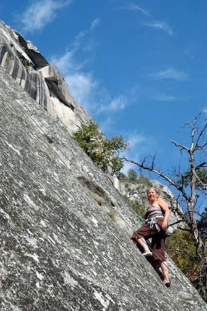
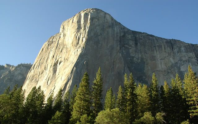
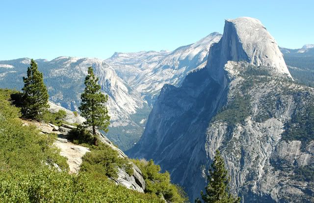
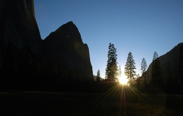
....I have to admit that I wrote the part above a month ago, and have procrastinated since then. In order to at least get somewhere, I'm going to post some of the landscape photos. Hopefully I will get back in here with some comments and also pictures of the people I met and hung out with on the trip.

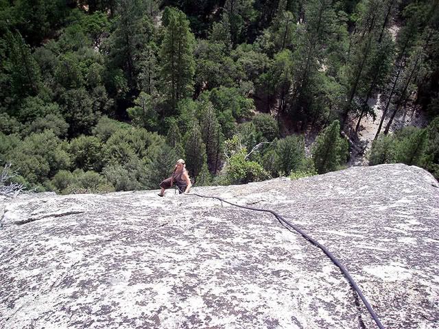
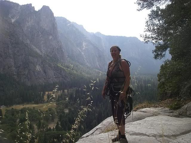
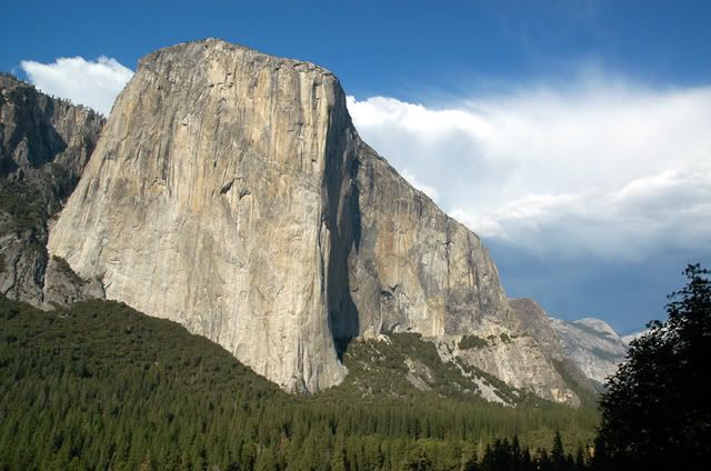
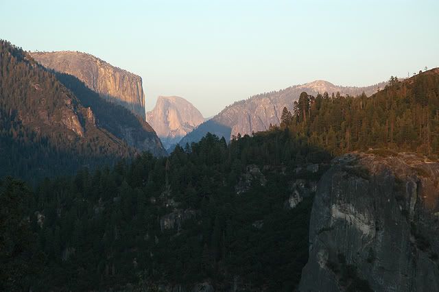
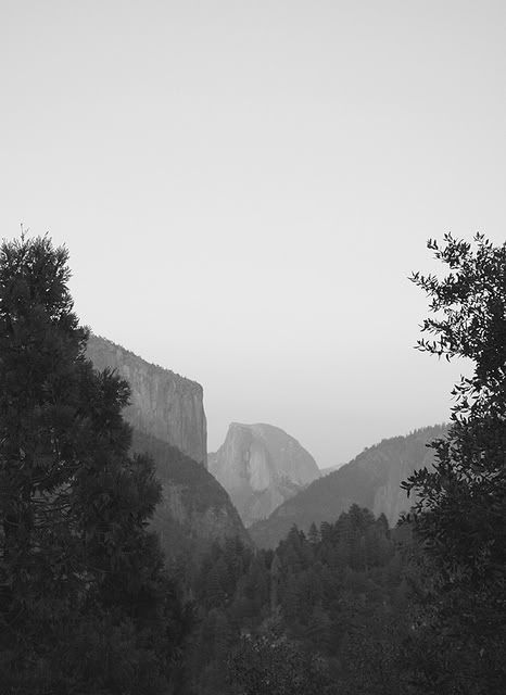
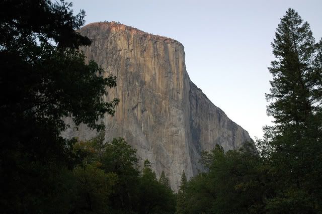
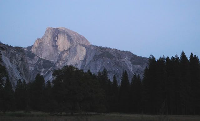
So - here are some photos from my first Valley visit!

Photobucket

Photobucket

Photobucket

Photobucket

Photobucket

Photobucket

Photobucket

Photobucket

Photobucket

Photobucket


Photobucket


~~~~~~~
If you enjoy my blog and would like to subscribe through RSS, you can click the FeedBurner Badge here. Thanks for your support!  Subscribe in a reader

~~~~~~~~~~~~~~~~~
Help support Happiegrrrl in her quest to travel, climb and live an adventurous life(instead of being stuck at home working.....). Visit her online shop, ClimbAddict, for original designs on t-shirts, jackets, caps, stickers and giftware.
Stumble Upon Toolbar

Tuesday, November 04, 2008

Happie Asks a Favor

Hey - I'm trying something new, and wonder if you might be interested in helping me out. In an effort to drive some business to my t-shirt shop, ClimbAddict, I have taken the suggestion of others and created a "lens" at Squidoo.com.

Wanna pop over there and read my article? It's called On Belay: Finding Rock Climbing Partners.

It's still a work in progress, and even when I have the article completed I will update content periodically. But it's my first time trying this, and I can tell you that it took a lot of effort and was pretty frustrating, trying to figure the thing out! At any rate, I am wondering how it comes off to the casual reader.

What I am thinking is that, when I have some topics I want to write about that are sort of more informational, rather than personal, I might create one of these Squidoo lenses and link it here on my blog. The reason for this is to reach a broader audience on both this blog and m ClimbAddict shop.

Why do I want to do that? Truth? Because I want to be a climbing bum, and can't get on the road if I am tethered to a my current situation. I have a great apartment in the middle of it all - if New York City is your center of existence! It isn't, for me, any more. I have an easy job, running a business with two wonderful assistants. But it doesn't support me lavishly, and without a little more lavishness, I simply can't fund climbing trips or a move to a closer proximity to the crags.

I am considering expanding the online shop to include designs related to camping, hiking, conservation and stuff like that, and the Squidoo site will also be an avenue for that.

At any rate - do take a click when you have a moment, and let me know what you think. You can leave feedback on the Squidoo lens, or come back here and tell me what you think of me - hahaha. Again - the link is On Belay: Finding Rock Climbing Partners. Any helpful suggestions are always appreciated!

EDIT: You know what? That Squidoo place is like a whole other world! Galaxies have collided.... I made some updates to make my first lens a little better, and have some ideas that I want to add next week after I get back from the Gunks.

If YOU are into blogging or other creative writing, you definitely might be interested in getting into the Squidoo Swing. Next week, I will start a "Group" over there, which is a collection of writers banded together to showcase their stuff. If you'd like an invite to that group once I have it established - let me know!

I think the group I make will be broader than climbing, as there is already one there, called Rock Squids, and they don't seem active. Too small a niche I guess. I'm thinking our group will be something about the idea of being adventure athletes and writers. The lens will be about Trip Reports, and in it we showcase the lenses we make about our days out there. Subject to change though - I am going to research a little further to see how this will fits in with the scheme of things.

~~~~~~~
If you enjoy my blog and would like to subscribe through RSS, you can click the FeedBurner Badge here. Thanks for your support!  Subscribe in a reader

~~~~~~~~~~~~~~~~~
Help support Happiegrrrl in her quest to travel, climb and live an adventurous life(instead of being stuck at home working.....). Visit her online shop, ClimbAddict, for original designs on t-shirts, jackets, caps, stickers and giftware.
Stumble Upon Toolbar